We have been a force in the taxi industry for over 10 years in Newton MA. Consistently providing excellent ground transportation to the residence , businesses, and visitors of the town of Newton. We have always driven innovation and are continually striving to create a better industry. Our goal is always customer satisfaction and we will always go the extra mile to support both our drivers and our passengers.
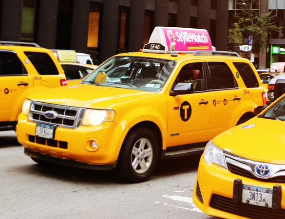
Our immaculate range of vehicles ready to pick you up. Whether you’re traveling alone or with a group, we have different type of car that will meet your need. Taxi Van up to 6 passengers, sedan up to 4 passengers and black cars and SUVs you want a luxury travel experience. We regularly update our fleet with the latest models. Our cars are equipped with, air-conditioning, sound isolation features, and spacious leg-room. All our driver are considerate, professional and careful. They are fully aware of passenger comfort and safety, route knowledge and tour management.
With transparent prices, no surge pricing, and a variety of convenient payment options, we make paying for your ride easy and painless. We are very confident that we are the most affordable taxi in Newton MA. For a hassle-free and quick reservation experience, call airport taxi at (781) 354-4070 get the booking confirmation instantly.
Newton is a suburban city in Middlesex County, Massachusetts, United States. It is approximately 7 miles (11 km) west of downtown Boston and is bordered by Boston's Brighton and West Roxbury neighborhoods to the east and south, respectively, and by the suburb of Brookline to the east, the suburbs of Watertown and Waltham to the north, and Weston, Wellesley and Needham to the west. Rather than having a single city center, Newton resembles a patchwork of thirteen villages. According to the 2010 U.S. Census, the population of Newton was 85,146, making it the eleventh largest city in the Massachusetts. Bellow the thirten newotn villages:
The area that is now Newton was part of a tract of land taken from Watertown and given to Cambridge in 1633. Soon after, a handful of families settled near the Newton-Brighton line, and the first cartways set the pattern for what would become the main highways. These converged a short distance south of the Watertown bridge and a small community developed at the intersection. There were at least two shops there by 1726, and shortly afterwards a tavern was opened by Oakes Angier. He ran it long enough for the hamlet to become known as "Angier's Corner."
From the beginning of the nineteenth century, stage coaches to the west passed through the Corner, and from 1834 the Boston and Worcester Railroad did likewise. When commuter service was inaugurated ten years later, the local station became known as Newton Corner.
To the east of the village, another, almost independent, community came into being. Its original focus was a small industrial complex on the river started by David Bemis as a paper mill in 1778. This was the forerunner of other factories that came to the area in the mid-1800s. One, the Nonantum Worsted Company, gave its name to the neighborhood in the 1880s. The original Nonantum had been the village near Newton Corner established for the Indians by the Reverend John Eliot in 1646.
The Charles River in Newton was used as a source of power for the first time in 1688 when a sawmill was built at the upper falls. During the next ninety years other family-run operations were added.
There was no significant growth in population until after the Revolution. Then, new capital and expanded opportunities stimulated the establishment of textile mills at the upper (later Silk Mill) dam, iron works at the lower (Metropolitan Circular) dam, and machine shops on South Meadow Brook. Together these led to the growth of the settlement at Upper Falls, which, by the 1820s, was well on the way to becoming a prototype of the self-contained New England mill village, with the houses of the workers close to the mills and those of the more affluent on the hillside above.
There was a grist mill at the lower falls on the Wellesley (then Dedham) side of the river by the mid-1690s and thirty years later a forge and trip-hammer were built on the Newton bank. These were followed by a variety of small mills until about 1790 when John Ware built the first of the paper mills for which Lower Falls was later well known. By 1816 there were six at the upper (Cordingly) dam and three at the lower (Washington Street or Finlay) dam.
The community that developed at Newton Lower Falls had an added advantage. Since the late 1600s two major east-west highways, the roads between Watertown and Natick, and from Boston to Sherborn, had met there before crossing the river at the County (Wales Street) Bridge. Thus, there were inns in the village before the Revolution, at least one store before 1800, the first post office in Newton (1813) and, before the railroad spur was built in 1840, daily stage coaches to Boston.
In 1660 the few Cambridge families living on the south side of the river built their own meeting house in the burying ground at the corner of Centre and Cotton streets. The site was convenient at the time and when Newton became an independent community in 1688, other town facilities were located nearby.
In 1712, when settlement had spread further afield, the General Court, responding to the petitions of families living to the south and west, ordered that the meeting house be moved to a location equally accessible to all residents.
After a surveyor had determined the center of the town, new roads were laid out to the site from the outlying areas. In 1721, the new meeting house at the corner of Centre and Homer streets was completed. The "Centre" came into being as one by one the other services followed: school, stocks, training field, pound and eventually the town house.
However, due partly to the physical obstacles that isolated it from the developing population centers on the river and in the north part of the town, Newton Centre s period of pre-eminence was relatively short, and, in 1849, after many bitter debates, the town house was moved to West Newton. But, even though no longer the administrative, nor, following the loss of territory to Roxbury and Waltham, the geographic center of town, the village of Newton Centre remains "The Centre" to those who live there.
In 1761, when the (North Street) bridge was built across the Charles between Newton and Waltham, a road was laid out from the river to connect it with the highways to Watertown, Natick and Weston, which met at what was to become the center of a new village: West Newton Square.
The meeting house built there in1764 became the Second Church in Newton when the West Parish was incorporated in 1781. An early tavern was superceded by bigger and better facilities as stage coach and, later, train traffic increased. Proximity to the railroad, which drew many new residents to the north side of the town, contributed further to the development of West Newton and was an important factor in having the Town Hall transferred there from Newton Centre in 1849.
Two of Newton s villages developed as a direct result of the opening of the Boston and Worcester Railroad in 1834 and the introduction of regular commuter rail service to Boston ten years later.
When the railroad opened a depot midway between the stations at Newton Corner and West Newton, there was little to suggest that this would become the center of a thriving village and home to the town s first high school.
For a decade there were only two buildings in the vicinity: the old Hull mansion from which the depot took the name of "Hull s Crossing", and a storehouse for the grain from Joseph Bullough s grist mill. Passengers were few, and trains stopped only if "flagged." Within two years of the introduction of commuter service, the first house lots (south of Washington Street between Lowell Avenue and Walnut Street) were sold at auction. This was the beginning of the development of Newton s first "railroad village." The name "Newtonville" first appears in the Town Meeting records in 1847.
The Reverend Charles duMaresque Pigeon, grandson of an eighteenth-century local notable, is credited with being responsible for persuading the railroad to introduce a flag stop on its line two miles west of West Newton. This led to a flurry of real estate activity: there were three major sub-divisions in 1847 alone. Such were the beginnings of the village that became famous as the home of Norumbega Park and the Riverside Recreation Area on the Charles River.
The number of clergymen living in the village in the early years prompted the light-hearted to call it "Saints Rest", but "Auburn Dale", attributed to the Reverend Pigeon, was in general use from the beginning.
Development of the southern part of town was unaffected by the Boston and Worcester Railroad, and when the Charles River Railroad was built in 1852, carrying passengers was not its primary purpose. Only when the two railroads were joined to form the Circuit in 1886 did substantial growth take place there.
In 1821 Joseph Lee, a retired sea captain, bought 165 acres which, for generations had belonged to the Hammond family. He died, unmarried, in 1845 and left the farm, located partly in Newton and partly in Brookline, to his nieces and nephews.
For a time, the bequest was regarded as something of a white elephant. As none of the legatees lived in the area and their interests were oriented towards Boston, the property seemed remote and inaccessible. However, in 1850, Beacon Street was laid out connecting Newton Centre with the road across the Back Bay in Boston, and two years later the Charles River Railroad was extended from Brookline to the factories at Upper Falls. Although not intended for passenger service, this, along with Beacon Street, made Boston seem within easier reach, and Lee s heirs decided that the farm had possibilities after all. They not only built homes there for themselves, but also laid out a sub-division creating a new suburban community for which they chose the name "Chestnut Hill."
Although there was nothing resembling a village in the immediate vicinity, a station was built on the site of the present Newton Highlands T stop when the Charles River Railroad was extended through Newton in 1852. The stop was called "Oak Hill" after the large, sparsely populated area south of the track that it was meant to serve.
Initially, the railroad brought little change to the area: the passenger service was too erratic to attract commuters, and the single track was used mostly by cars carrying gravel from Needham to fill the Back Bay. However, by the early 1870s, when that project was virtually complete, the railbed was upgraded and service improved. As a result, the area north of the track experienced its first period of development and the basic street pattern took shape. At a meeting called specially for the purpose, "Newton Highlands" was chosen as the name for the emerging village.
In 1855 Beacon Street was continued westward from Newton Centre to the junction of Woodward and Washington Streets. This intersection was also the meeting place of the four farms that covered nearly all of present-day Waban. Thus things remained until, in 1886, the Boston and Albany Railroad created the Circuit Railroad by upgrading the old Charles River line and extending it to meet the main line at Riverside. The advantages of the resulting excellent commuter rail service were not lost on local real estate developers, and within the next few years subdivision followed subdivision and houses and stores appeared. The station, built near the old crossroads, was given its name by William Strong who, before he moved to the area, lived on Nonantum Hill near the site of the vanished village of Waban and the Praying Indians.
In 1702 the selectmen accepted land for a second school in "Oak Hill." By the standards of the day the site was easy of access: the roads from Watertown, Dedham, Brookline and Needham met there. Nevertheless no further amenities were added and the name continued to denote an area rather than a community.
Much of the surrounding land was wet meadow, and the farms were large and scattered. Over the centuries the population remained virtually static and the street patterns undisturbed. Neither the stage coach nor the railroad ventured there, and only in the first decades of this century, when the automobile made it worth while and technology made it feasible, was the soil drained to make development on any scale possible.
Boston Logan International Airport opened on September 8, 1923, and was mainly used by the Massachusetts Air Guard and the Army Air Corps. Officially known as General Edward Lawrence Logan Airport, and also commonly known as Boston Logan International Airport or simply Logan Airport. is an international airport that is located mostly in East Boston and partially in Winthrop, Massachusetts, United States. It covers 2,384 acres (965 ha), has six runways and four passenger terminals.
Logan Airport has 4 passenger terminals—A, B, C, and E—with Terminal E handling international traffic. With 102 gates in total, it is the largest airport in the New England region in terms of passenger volume. It employs an estimated 16,000 people. It is the largest airport in both the Commonwealth of Massachusetts and the New England region in terms of passenger volume and cargo handling, as well as the 16th-busiest airport in the United States, with 38.4 million total passengers in 2017.
Boston Airport has 4 main passenger terminals: A, B, C, and E. Arrival and baggage claim are down level while departure are Upper Level. You can plan your trip using the information below to see which terminals you need to go.
Find more information about Logan Here. Also Facebook and Twitter.
Our cars are having attractive and comfort interior to make your journey unforgettable with smooth traveling.
We are always ready to pick and drop you over the city and surrounding areas.
You can book your taxi by making a telephonic call at (781) 354-4070 or on our websites.
We accept all major credit cards and can send an electronic receipt.
We have more taxicab than all other taxi companies in the area.
Reliable, professional and friendly drivers.
Available Minivan, Sedan car, SUV and Town car.
Competitive rates in the city.
Get Estimat or Resever Now, See FAQs